Generated with AI
Theodolite
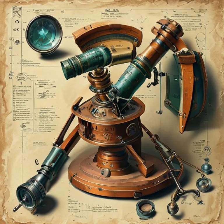
Brief description
Precision measurement instrument used in Surveying and engineering to measure angles in horizontal and vertical planes. It is essential for triangulation and precise mapping.
Use / Function
- Surveying: Mapping terrain, determining property boundaries.
- Construction: Aligning roads, tunnels, and building foundations.
- Geodesy: Measuring the Earth’s curvature through large networks of triangles.
Operating principle
Combines a telescope with two graduated circles (one horizontal and one vertical).
- The operator points the telescope at point A and reads the angle.
- Then points to point B and reads the new angle.
- The difference is the angle between the two points. The telescope can rotate freely on both axes.
How to create it
- Base: A stable tripod with leveling screws.
- Mount: A vertical axis allowing horizontal rotation (azimuth).
- Telescope: Mounted on a horizontal axis (elevation).
- Graduated Circles: Metal or glass plates with very fine degree markings.
- Spirit Levels: To ensure the instrument is perfectly horizontal.
Materials needed
- Essential: Brass or Aluminum (non-magnetic to not affect nearby compasses), Optical glass (lenses).
- Tools: Precision lathe, dividing engine to graduate circles.
Variants and improvements
- Total Station: Modern electronic version including a laser distance meter and computer.
- Transit: Robust American version where the telescope can be inverted completely.
Limits and risks
- Fragility: Lenses and axes are delicate; a knock can misalign it.
- Requires Tripod: Needs a firm and stable base.
- Atmosphere: Heat haze/refraction can distort vision over long distances.